The Military Features Template is now available for download from ArcGIS.com.
The Military Features Template is an Esri Defense template for importing and exporting military features symbolized according to MIL-STD-2525C or APP-6(B), for planning, operations, and intelligence use.
View a brief video about the template.
The tools included with the template enable exchange of military features between ArcGIS and other systems via XML files containing symbol identification codes (SIDC) and other attributes.
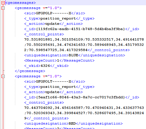
Sample XML geomessages derived from military features.
They will also interpret SIDC attributes on simple GIS features to create correctly symbolized military features.
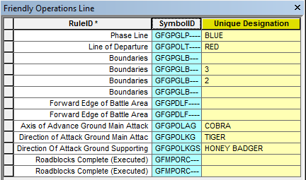
Sample list of symbology codes.
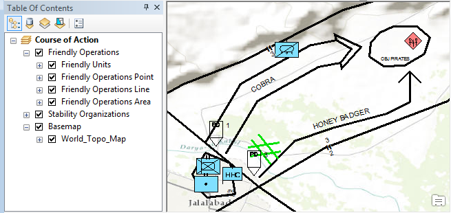
The template includes updated ArcGIS style files for MIL-STD-2525C and APP-6(B) symbology, schema-only layer packages to create geodatabases with appropriate military feature schemas, and a set of tools and an ArcGIS Engine stand-alone application for importing and exporting features with military symbology.
These tools* allow you to:
- import features from shapefile or geodatabase with an SIDC attribute to military features with appropriate symbology;
- import XML message files from other systems to military features;
- calculate SIDC values for military features;
- export military features to XML message files for use in other systems.
The template also contains two tutorial exercises with sample maps, data, and message files to help you learn to use some of the tools.
The tools and source code are also available on GitHub at: https://github.com/Esri/military-feature-toolbox. The XML files imported and exported by the tools must be in the Esri geomessage format, used by the Esri GeoEvent Processor for Server (http://www.esri.com/software/arcgis/arcgisserver/extensions/geoevent-extension), but the Python scripts (available with the tools on GitHub) can be modified to read and write XML structures native to other applications.
*The tools are:
- Append Military Features
- Append Military Features from Workspace
- Calculate SIDC Field
- Calculate Representation Rule Field
- Write Message File from Military Features
- Write Message File from Military Features (No Geo Transform)
- Append Message File from Military Features
- Write Military Features from Message File
- Append Message File from Military Feature Workspace


